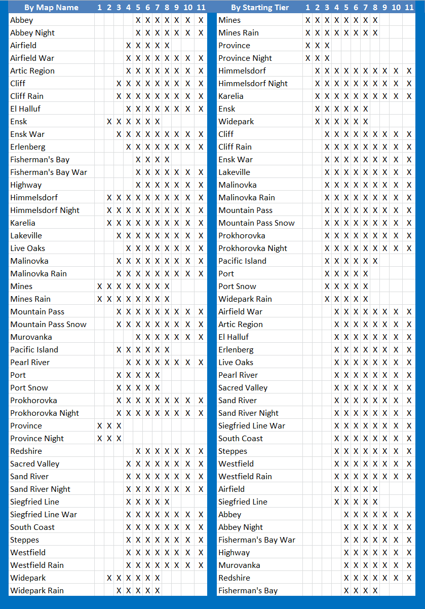
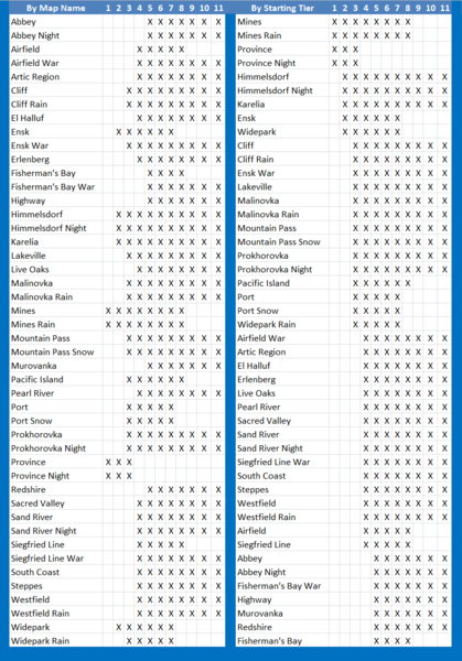
File:Map Tiers.png
Size of this preview: 419 × 600 pixels. Other resolution: 839 × 1,201 pixels.
Original file (839 × 1,201 pixels, file size: 95 KB, MIME type: image/png)
A breakdown of which tier will see what maps.
File history
Click on a date/time to view the file as it appeared at that time.
| Date/Time | Thumbnail | Dimensions | User | Comment | |
|---|---|---|---|---|---|
| current | 00:00, 4 April 2015 | | 839 × 1,201 (95 KB) | A breakdown of which tier will see what maps. |
- You cannot overwrite this file.
File usage
There are no pages that link to this file.